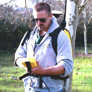
WELCOME to the Civil Engineering, Surveying and Geospatial Technology (CESGT) Program.
A.) EVERY land development project begins and ends with a LAND SURVEYOR. They capture the landscape for the design engineers, locate where design grading and building will occur on the site, monitor changes and document what is finally constructed (as built).

B.) DURING that process CIVIL ENGINEERS will plan, design and oversee construction.

C.) Collecting, analyzing, managing and displaying land information either before, during or after the project/development is one of the primary roles of the GIS MAPPER & ANALYST.

As it has grown, and evolved, the CESGT program has gone by other acronyms over the past 35+ years of its existence at SRJC (CET, CEST, CESGT).
In keeping with the new, more focused, SRJC "Year to Career" theme, the CESGT Program has been streamlined from three 2-year certificates/degrees into three, stackable, 1-year certificates/degrees.
You are invited to explore the exciting and rewarding career possibilities in the Civil Engineering, Land Surveying and Geospatial professions by examining each of the web pages associated with all three disciplines. They are interrelated, so don't be surprised if you are attracted to more than one. The CESGT Program Coordinator can help you with your decision and your plan to take CESGT courses leading to a certificate and/or degree.
-Civil Engineering Technology Program Webpage-
-Geospatial Technology Program Webpage- NOTICE:
The Geospacial Technology (GIS) Program is going on hiatus beginning Fall 2019. We hope to retool the program and bring it back in the future. We will continue to offer the GIS 40 (Intro to GIS) course as it is needed for other programs at SRJC.
-Surveying Technology Program Webpage-
Civil Engineering, Geospatial & Surveying Technology Programs Coordinator:
Reg Parks
Office Phone #: (707) 527-4376
E-mail: rparks@santarosa.edu
CESGT students will work in state of the art computer labs on workstations equipped with current design, analysis, plotting and mapping applications from Autodesk, Adobe, ESRI, Ashtech, Topcon, Trimble, MicroSurvey, HP and other leading software manufacturers. The program is equipped and continually updating its land survey and GIS field hardware and software so that students learn how to operate the equipment that they are likely to encounter on the job.
The SRJC CESGT certificate programs are tightly integrated with the local and regional professional communities. Special grants and awards have been established within the CESGT professional communities and are awarded each semester to qualifying student applicants. Students are encouraged to attend professional organization meetings in the area and network with potential future employers
SRJC students completing one of these degrees or certificates will be fully prepared to directly enter the workplace in that field. Many of the SRJC courses numbered 1-99 could also be used to fulfill major requirements or electives at CSU and UC campuses in fields such as Construction Management and Civil Engineering. Consult with your counselor regarding any plans for transfer.
Here are some additional program highlights:
Employment:
- summer internships and work study programs are available,
- all Spring 2015 graduates of the former 2-year programs are employed locally or regionally,
- many were employed after their first year or into their second year,
- students are placed with local civil engineering firms, land surveying firms, municipalities, county government, utility companies like PG&E and state agencies like CalTRANS,
Academic Achievement:
- the program streamlining has retained the rigor for which it became nationally recognized,
- the program has retained the required courses necessary for 4-year Engineering transfer students (GIS40 and SURV50 now called SURV60),
- students can achieve most of the former 2-year curriculum by completing two 1-year certificates, this is possible to achieve in one year but will require diligence and advance planning.
Comparison:
- the SRCJ CESGT Program is the only comprehensive program serving northern California and parts of central California,
- there are only three similar JC programs, two in southern California, one in San Jose,
- there are two similar 4-year programs, both in central and southern California (Fresno State and CalPoly Pomona),
- both of the 4-year programs accept selected courses offered at SRJC for transfer,
Student Opportunities:
- the CESGT program offers roughly $30k in annual scholarships every year from the public and private sector ranging from a few hundred dollars to over a thousand dollars,
- students must apply through the program, see the scholarship board outside my office,
- the program offers students an opportunity to work with cutting edge technology in the office and in the field,
- these specialized field experiences along with the in-class course content help to prepare students for meaningful careers in the civil engineering, land surveying and geospatial mapping disciplines as well as for potentially successful transfer to corresponding 4-year programs.
The reader is encouraged to review the basic CESGT course sequence for each of the 1-year programs. Please direct interested students to my faculty website for additional course and contact information.
|
Reg Parks, BA/S, MS, LSIT, GISP Instructor / Program Coordinator Civil Engineering, Surveying & Geospatial Technology Program Department of Engineering and Applied Technology Santa Rosa Junior College 1501 Mendocino Avenue Santa Rosa, CA 95401 https://profiles.santarosa.edu/reg-parks (Visit my faculty web page for my schedule and course updates) |
|
